


Scafell Pike Offline Map app for iPhone and iPad
Developer: Jack Dearlove
First release : 10 Apr 2021
App size: 38.72 Mb
Planning to climb Scafell Pike? You’ll need to know two things, where to go and what the weather’s like – and Scafell Pike Offline Map covers both
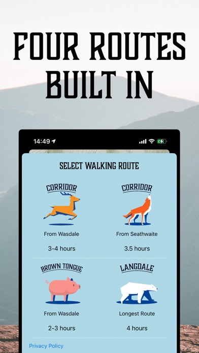
The perfect travel companion, Scafell Pike Offline Map includes four routes up the mountain pre-installed, so you don’t have to hunt around the internet for a GPS file. Just select your route and follow the red line all the way to the cafe at the top, it even works without an internet connection.
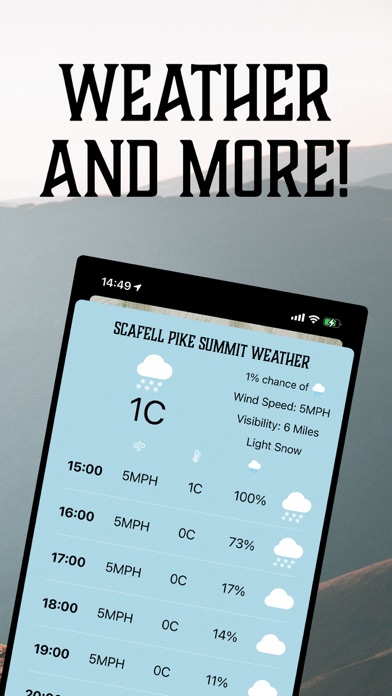
Scafell Pike Offline Map also includes a detailed summit weather forecast for the next six hours and an overview of the weather tomorrow, so you can plan your journey and know what to expect on the way up and the way down.
Full features include:
- Full navigable map of Scafell Pike and the surrounding area.
- Pinch to zoom to see more detail.
-Preinstalled route data for four marked trails (The Corridor Route from two different start points, the Brown Tongue route and the longest route from Langdale).
-Easily overlay your walking route over the map without having to download additional files from the internet.
- Offline compatibility, so you can navigate your way to the summit, even when you have low or no signal.
- Location tracking, so you can see exactly where on the mountain you are.
- Compass so you know which direction you’re facing.
- Comprehensive weather outlook for the summit over the next six hours, so you can be prepared for the changing weather at the top.
- Weather summary for tomorrow, so you can plan for what you’re walking into.
I climbed Scafell Pike a few years ago and it was an incredible experience. Scafell Pike Offline Map will help you do the same, without having to worry about getting lost.
Map data from Mapbox
Additional graphics from Vecteezy.com
Additional Images from Unsplash